OpenWorld Atlanta

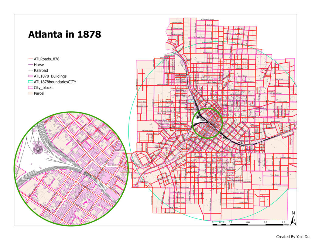
The map is showing the roads, parcels, city blocks, etc. in Atlanta in 1878.
In a compelling demonstration of geospatial technology and historical research, I spearheaded an analytical project that intricately combined 19th-century plate maps of Atlanta (circa 1878) with modern geocoding techniques using ArcGIS Pro. This project meticulously identified and visualized the evolving dynamics of the cityscape, focusing on street names, parcel usage, and building typologies from the past to present. Leveraging extensive datasets—including historical census information—I developed comprehensive GIS maps that not only depicted, but also analyzed the transformation of urban land use over nearly a century and a half. This work forms a critical component of the “Open World Atlanta” project, a broader endeavor aimed at juxtaposing historical and contemporary land use patterns within Atlanta. Through this project, my efforts illuminate the profound changes in Atlanta’s urban fabric, offering invaluable insights into urban development and planning strategies.
